New Homeowner Gets a Survey Done and Finds the Neighbor’s Storage Shed Sitting on Their Land — Then the Neighbor Says the Surveyor Must Have Made an Error
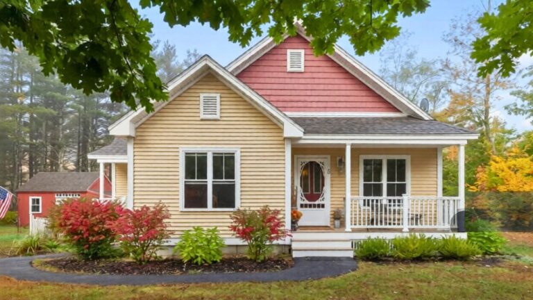
It started as one of those things you notice as a kid and file away without thinking too hard: the neighbor’s storage shed seemed a little close to the house. Years later, on a visit back to their parents’ place, one adult child looked at that same shed and couldn’t unsee it anymore—close enough to feel like it might actually be over the line.
Instead of marching next door, they did what a lot of homeowners do now: pulled up the county website and started digging. In the original post, they describe finding general lot maps at first, then discovering GIS and “image mate” tools that seemed to show a property-specific layout for the parents’ parcel. That’s when the stomach-drop moment hit: the county drawing appeared to show the parents having two sheds—while the neighbor’s property survey map showed no shed at all.
The first sign was easy to brush off
The shed wasn’t new. It had been sitting there “years and years,” close to the family home, close enough that it always seemed a bit off. But when you live next to someone, there’s a natural pressure to not turn every annoyance into a confrontation—especially if it doesn’t obviously affect day-to-day life.
That’s the trap with property-line issues: they can sit quietly for years, until a life change forces you to look at them like a buyer, a seller, or an insurer would. A shed that’s “probably fine” becomes a question that won’t let go the moment you think about title paperwork, resale listings, or a future dispute.
A few clicks turned into a big boundary question
Once the shed looked suspicious again, the poster went looking for “official documentation” online. County sites make it feel straightforward—maps, layers, parcel outlines, sometimes even structures. And when you find a drawing that looks property-specific, it’s tempting to treat it like a final answer.
What really tightened the knot was the mismatch. The parents’ property layout showed two sheds, which made the poster suspect the neighbor’s shed might be counted as sitting on the parents’ land. Then they looked up the neighbor’s property survey map and didn’t see the shed shown there at all.
That’s the moment a casual concern turns into a real-world problem with real consequences: if that structure is over the line, who owns it, who’s responsible for it, and what happens if someone decides to force the issue?
The neighbor’s “it must be wrong” response is common
The headline version of this story is familiar in almost every neighborhood: a new or newly attentive homeowner gets a survey, discovers an encroachment, and the neighbor’s first move is denial. Not necessarily angry denial—sometimes it’s just disbelief—because admitting a shed is on someone else’s land opens a messy box.
Even in the poster’s earlier stage—before hiring a private survey crew—the tension is already there. The county map appears to suggest one thing; the neighbor’s documents suggest another. If the family approaches the neighbor with screenshots from GIS, there’s a good chance the neighbor will say the mapping is off, the drawings are outdated, or the “surveyor must have made an error.”
And from a practical standpoint, that kind of pushback matters because moving a shed isn’t like sliding a patio chair. It can mean jacking it up, hiring a crew, repairing the pad, rewiring power if it’s electrified, and regrading the ground. People don’t volunteer for that without being forced.
County GIS looks official, but it’s not always “the line”
The poster’s core question is the one that trips up a lot of homeowners: can you use county or government parcel maps as proof that a neighbor built on your land? They found GIS and image tools on the county website and wondered if those could serve as official documentation.
Those maps can be incredibly useful for getting oriented, but they’re often built for assessment and reference, not for settling boundary disputes down to inches. A map might show a structure because of aerial imagery interpretation or tax-assessor records, not because a licensed surveyor set monuments and verified corners on the ground.
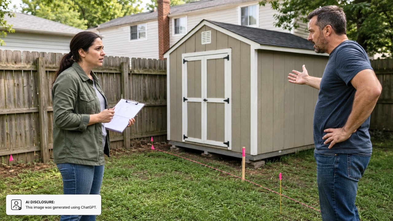
The poster also wondered if “there is another level of detail” when you hire a private surveying company—and that’s where the story starts to feel expensive. If the family wants the neighbor to remove or relocate the shed, the kind of proof that holds up in a serious dispute usually involves a boundary survey with fieldwork, marked corners, and a stamped drawing.
That’s the hard part: you can suspect you’re right and still have to pay to prove it in a way that’s actionable.
Resale turns a quiet encroachment into a loud problem
The poster’s mind went straight to the scenario that keeps homeowners up at night: what happens if the parents sell? If the shed is actually on the parents’ parcel, the poster reasoned, then the shed would be included in the sale. And suddenly this isn’t just about annoyance—it’s about what a buyer thinks they’re purchasing.
That leads to an even thornier hypothetical: if new buyers come in and like the idea of “two sheds” as a selling point, can the neighbor demolish or take the shed back because they built it? The poster doubted the neighbor would “willingly hand over a shed,” but also doubted new owners would tolerate someone stepping onto their property to mess with a structure sitting there.
That’s where these disputes get sharp edges. A structure that crosses a boundary can turn into a chain reaction: seller disclosures, buyer demands, lender questions, and bad blood between households that used to wave politely. Even if everyone wants to be reasonable, the logistics alone—access, timing, cost, and liability—can make “just move it” feel impossible.
People zeroed in on proof and paperwork before a showdown
Even without a flood of quoted comments in the source material, the direction of the discussion is easy to predict because the poster asked the exact questions homeowners ask right before things escalate: are the county maps accurate enough, and do we have to pay for a real survey if we want action?
In these situations, the most practical voices typically push for slowing down and getting clean documentation before anyone starts accusing anyone of trespassing. That means keeping copies of what the county site shows, comparing it to any surveys already in the family’s closing documents, and then deciding whether it’s worth hiring a licensed surveyor to mark corners and produce a stamped plan.
The reason is simple: once you confront a neighbor, you can’t un-confront them. If you’re wrong—or if the line is different than the web map suggests—you’ve picked a fight you didn’t need. If you’re right, you still need something stronger than a screenshot to get a reluctant neighbor to spend real money moving a building.
For now, the shed is still where it’s always been: close, awkward, and suddenly impossible to ignore. The family has a digital trail that suggests something’s off, but turning that into a clean resolution—without blowing up the relationship next door—usually starts with one unglamorous step: figuring out where the actual line is, on the ground, not just on a county webpage.
Like Fix It Homestead’s content? Be sure to follow us.
- Man Says He Found Out the Fence He Paid For Wasn’t Actually on His Property
- Woman Says Her Neighbor Started Taking Mulch From Her Delivery Pile Before She Could Even Spread It
- I made Joanna Gaines’s Friendsgiving casserole and here is what I would keep
- What Caliber Works Best for Groundhogs, Armadillos, and Other Digging Pests?